Begin with the route, not the monument
A canal is easiest to understand as part of a network. Before looking closely at an individual lock or bridge, ask what the waterway connected and why that connection mattered. Scotland’s canals served different landscapes: the Forth and Clyde Canal crossed the Central Belt, the Union Canal linked Edinburgh with the Falkirk area, and the Caledonian Canal uses lochs and constructed channels through the Great Glen. Their surviving structures reflect different geographical problems, not one standard canal story.
A useful first step is to compare the canal with the land around it. Where does the route follow a contour, and where does it need an embankment, cutting or lock? Does a road approach the water, or run past without meeting it? These relationships can suggest where cargo was once transferred and where the canal was primarily a passage between destinations. A present-day path or park may make a site feel self-contained, but the canal was built to connect places beyond the view from its banks.
Locks make changes in level visible
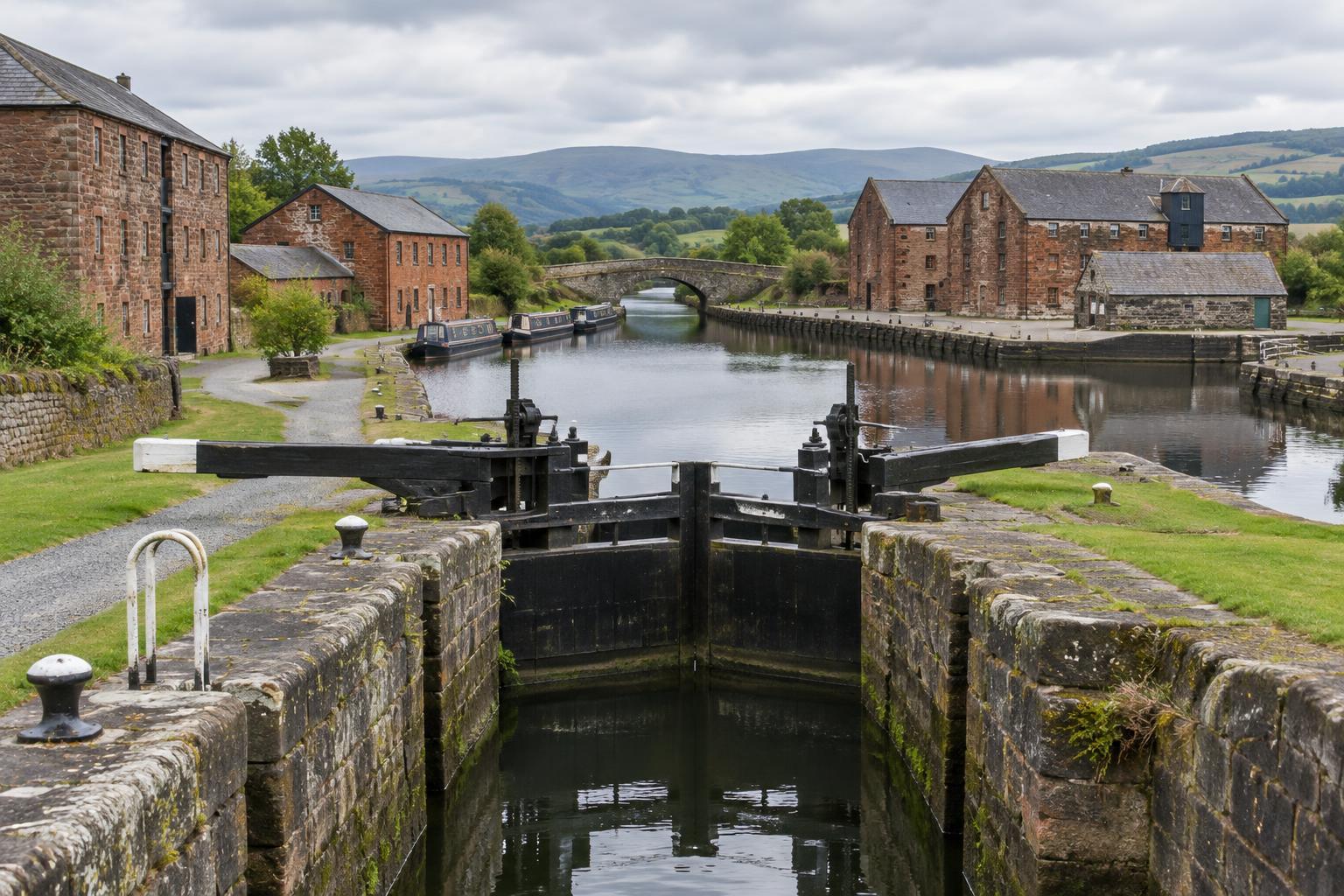
A lock is a controlled step in the waterway. Its chamber, gates and adjoining channels allow a boat to move between stretches of water at different heights. Standing beside one, look beyond the gates: the approaching canal, the position of bridges and any nearby buildings help explain how boats reached the lock and how work was organised around it. A flight of locks can be especially revealing because it turns a change in terrain into a sequence of built spaces.
The details reward patient observation. Worn edges, replaced gates and altered paths show that a working structure can have a long life of repair and adaptation. They do not, on their own, identify a precise date or a particular cargo. Likewise, a picturesque lock cottage may point to the need for people near the waterway without telling us exactly how its occupants lived. Treat visible fabric as evidence to investigate, rather than as a complete account.
For photography or documentary storytelling, a wide view can establish the climb, while closer views can show how gates and chamber walls shape movement. If the lock is still in use, watch from a safe public position and let its operation explain the engineering. There is no need to stage a scene as if the past were happening unchanged.
Basins show where the canal met the town
A basin widens the canal into a place where boats could pause, turn, load or unload. Its shape can be read alongside the streets that reach it. Look for broad approaches, former warehouse sites, walls, mooring edges or a building line that faces the water. Even when original structures have gone, the gap they occupied may help explain why that part of a town developed as it did.
Basins also make change unusually visible. A waterside space used today for leisure or housing may once have been arranged around handling goods. That contrast is worth describing, but it needs care: a converted building does not necessarily retain its original purpose in an obvious form, and an open space is not proof that a warehouse stood there. Historic maps, local collections and site interpretation can help test an impression formed on a walk.
Notice who can reach the water now. Paths, bridges and public spaces shape how a former working basin is experienced as heritage. They can invite visitors to look closely, while also hiding traces beneath new surfaces. A good account holds both ideas together: the site has a past worth reading and a present use worth observing.
Follow the links away from the water
Canal heritage rarely stops at the towpath. A road leading to a basin, a surviving industrial building or the course of a former railway may reveal how the waterway fitted into a wider transport system. Canals did not work in isolation; their usefulness depended on getting materials from mines, workshops, farms and ports to boats, and moving cargo onward at the other end.
Look for relationships rather than assuming every nearby ruin was canal-related. Is there a direct approach to the waterside? Does the ground suggest a loading area? Has later road building changed the route? Questions like these can guide further research without turning a visual resemblance into a firm claim. The absence of an obvious link can matter too. Demolition, redevelopment and changing industries may have removed the physical connections that once made the canal’s purpose clear.
This wider view is particularly helpful when telling a regional story. Instead of treating a canal as a line of attractive structures, follow one short stretch and ask how it connected a settlement with work beyond the bank. A modest bridge or access lane may become as important to that account as a celebrated engineering landmark.
Make room for what the landscape cannot tell you
Walking a canal provides evidence, but not a full record. Water levels, bridges, buildings and surrounding streets may have changed repeatedly. Begin with what you can see, then distinguish it from what you infer. If you use an archive image, check its caption and location rather than assuming it depicts the exact spot in front of you. If a structure’s original function is uncertain, say so.
That approach makes canal heritage more engaging, not less. Locks reveal how a route met uneven ground; basins show where movement became exchange; former industrial links point towards the labour and materials that kept the network useful. Read together, these features turn a walk beside the water into a way of asking how a Scottish landscape was built, used and remade.