The harbour as a town’s working centre
In a fishing town, the harbour was more than a place to tie up boats. Crews needed a safe approach from the sea, room to land a catch, and nearby space for gear, supplies and transport. Those needs helped shape the waterfronts of northeast Scotland. At places such as Peterhead, Fraserburgh and Buckie, harbour works and the streets behind them reflect the practical demands of getting people and fish between boat, shore and town.
Harbours did not acquire their present outlines all at once. Piers, basins and quays could be extended or adapted as boats, fishing methods and trade changed. A sheltered corner useful to a small vessel might no longer suit a larger one. When looking at a harbour today, it helps to ask which parts appear designed for landing, which for shelter, and where routes lead inland. The shoreline may look fixed on a map, but much of its visible edge has been built and rebuilt.
Why routes to the water mattered
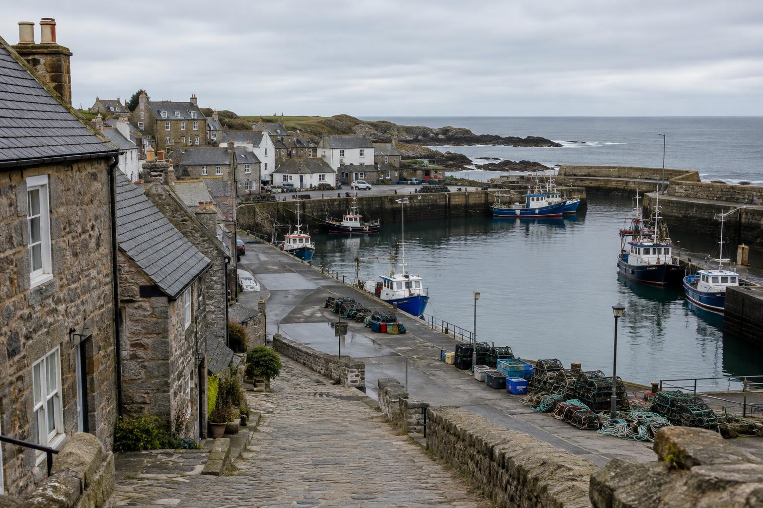
A catch had to move quickly after landing. Short connections between the quay and places for sorting, selling, processing or onward transport made a difference to daily work. In older parts of a coastal town, a lane descending toward the harbour or a broad street near the waterfront may hint at that movement. Its shape alone cannot prove its original purpose, but it offers a useful question: what needed to pass along this route, and who used it?
Fishing also linked the waterfront to a wider network of roads and, in some periods and places, rail connections. As distribution changed, so did the value of particular sites. A building close to the quay might suit one kind of work, while another business needed easier access to vehicles. These shifts could leave a patchwork of older lanes, larger working areas and newer road layouts rather than a single, neatly planned fishing district.
Work beyond the boats
The built heritage of fishing includes more than vessels and harbour walls. Nets and lines needed attention; catches needed handling; equipment needed storage and repair. During the herring trade, curing and packing also required space ashore. The amount and type of activity varied between towns and over time, so it is worth resisting the idea that every stretch of coast followed the same pattern.
Much of this labour could be difficult to spot in a present-day streetscape. A yard may have changed use, a working building may have been altered, and an open space may now look like an ordinary gap between properties. Domestic streets were part of the story too: the harbour was a workplace, but fishing households also depended on places to live, shop and gather. Looking from the quay toward the houses helps bring the town’s everyday life into view.
A shoreline that kept changing
Fishing towns had to negotiate the meeting point of land and sea. Shelter, water depth and access all mattered, yet no harbour could be separated from the conditions of its coast. Built edges altered how a town met the water, while later changes in vessels and harbour use could make earlier arrangements less suitable. An old quay, a newer basin and a repurposed waterfront building may therefore belong to different chapters of the same local history.
Change is not always a sign that heritage has been lost. A working harbour must remain usable, and adaptation can be part of its long story. At the same time, redevelopment can make earlier patterns harder to read. Preserving a photograph, map or account of a building before it changes can help explain what stood there and how it related to the streets around it. Such records are most useful when their date and context are clear.
How to read a fishing town on foot
Start at a public viewpoint above or beside the harbour and trace the routes inland. Where are the direct passages to the quay? Which spaces allow room for loading, storage or manoeuvring? Then look for changes in street width, building scale and the relationship between older structures and later waterfront works. These observations will not tell the whole story, but they can guide more focused questions.
Local maps, dated photographs and heritage displays can help test what the streets suggest. It is especially important to compare like with like: an image of a busy harbour captures one moment, not a permanent state. Northeast Scotland’s fishing towns were shaped by changing work as well as by the coast itself. Their streets and shorelines are most revealing when viewed as evidence of continuing choices about how to live and work beside the sea.